
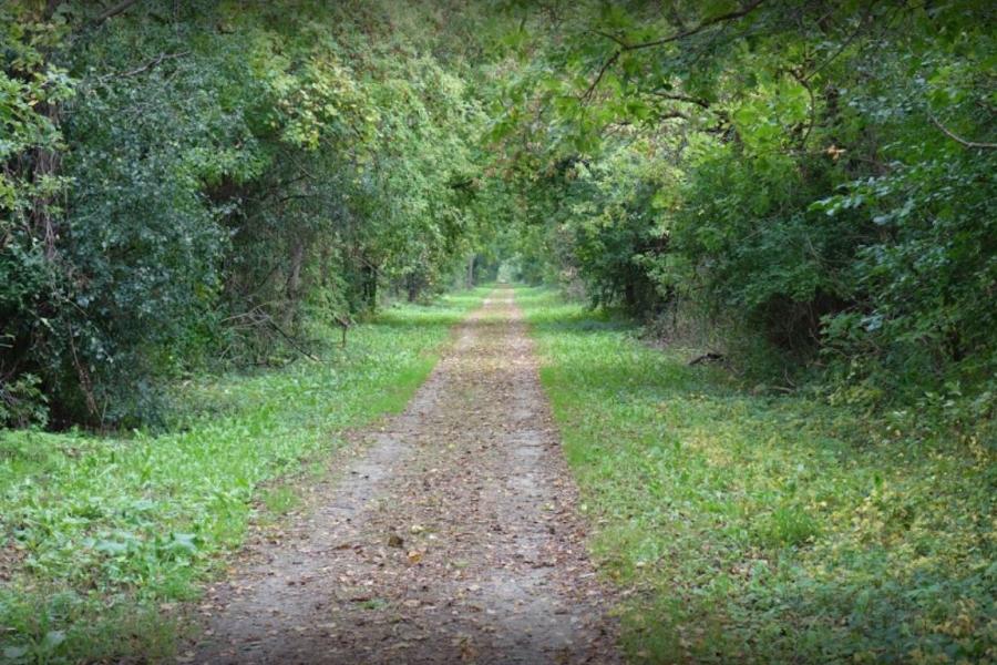
WIOUWASH TRAIL
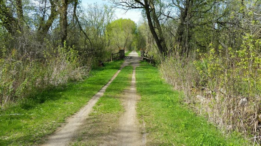
The Wiouwash State Trail, built on a former railroad corridor, is named after the four counties it runs through: Winnebago, Outagamie, Waupaca and Shawano. Lake Butte des Morts, grassland prairies, wooded areas and farmland offer views of diverse landscapes and wildlife. The flat base makes the trail perfect for a variety of activities throughout the year. The Wiouwash Trail crosses the Friendship Trail near Larson.
LENGTH
- 21.8 miles (from Downtown Oshkosh via Riverwalk to Hortonville)
SURFACE
- Crushed Limestone
ACTIVITIES
- Hiking
- Biking
- Horseback riding
- Snowmobiling
- Cross-country skiing
- Snowshoeing
- Fishing
AMENITIES
- Dogs Allowed
- Parking
PIT STOPS
- Bare Bones Brewery
- Fox River Brewing Company
- UW Oshkosh
- Rat River Wildlife Area
- Oshkosh-Larsen Trail Prairies
- Lake Butte des Morts
PARKING
- Oshkosh: The main parking lot for the trail in Winnebago County is located off Westwind Road, near the intersection of State Highways 41 and 45.
- Larson: Trail Head Park, at County Highway T, offers restrooms, picnic areas, a children's playground and parking areas for vehicles and horse trailers.
- Friendship Trail: The Wiouwash State Trail links to the Friendship Trail in Winnebago County at State Highway 10. The Friendship Trail parallels State Highway 10 into the town of Menasha where it crosses Little Lake Butte des Morts on a 0.8-mile rail trestle.
OSHKOSH RIVERWALK
The Riverwalk is a flat, paved trail along both sides of the Fox River connecting Downtown Oshkosh to the Wiouwash Trail. Enjoy great views of the river and a variety of restaurants, stores and attractions. Benches and parks along the Riverwalk offer relaxing picnic areas.
LENGTH
- 2 miles
SURFACE
- Paved
ACTIVITIES
- Walking
- Running
- Biking
- Fishing
AMENITIES
- Dogs Allowed
- Parking Downtown
- Community Pier
- Kayak Launch
- Sitting Benches
- Restrooms
- ADA Accessible
PIT STOPS
- Becket’s
- Dockside Tavern
- Ground Round
- Leach Amphitheater
- Riverside Park
- Steiger Park
- Oshkosh Seniors Center
PARKING
- West of Fox River: Near Fox Valley Tech on North Campbell Rd., Boatworks Park on Michigan St., Dockside Tavern on West 6th Ave.
- East of Fox River: Mahoney's on Wisconsin St., Becket's on Jackson St., Ground Round on Main St., Riverside Park on Ceape Ave.
TERRELL'S ISLAND TRAIL
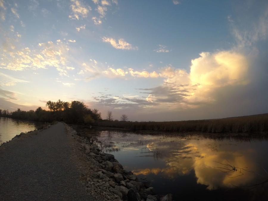
Terrell’s Island, a 1,200-acre wetland conservation project west of Oshkosh, is used to preserve and restore Lake Butte des Morts’ wetland and watershed habitat in Winnebago County. The Butte des Morts Conservation Club opened three Terrell’s Island trails for visitors, including the popular breakwall trail that goes out into Lake Butte des Morts.
LENGTH
- Out-and-back—2.4 miles each way
SURFACE
- Crushed Gravel
- Grass
ACTIVITIES
- Hiking
- Biking
- Fishing
- Canoeing
- Kayaking
AMENITIES
- Parking
- Dogs Allowed
- ADA Accessible
PIT STOPS
- Terrell’s Island
PARKING
- Follow Rivermoor Road north off Highway 21 to Schubert Road. Turn east on Schubert and follow to end. Follow signs to "Terrell's Island".
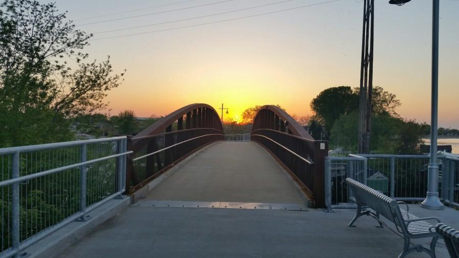
TRIBAL HERITAGE CROSSING OF THE WIOUWASH STATE TRAIL
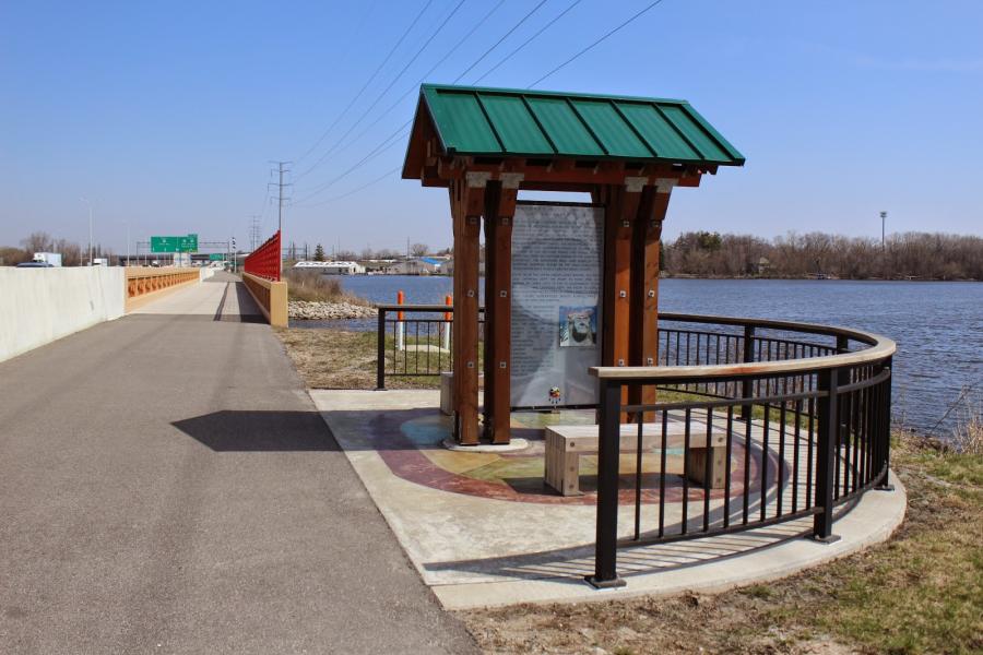
The Tribal Heritage Crossing Trail runs along the Interstate 41 causeway, connecting to the Wiouwash State Trail on the north end of the bridge over Lake Butte des Morts. The flat, paved trail is used for exercise, travel and fishing. There are also educational stops with interpretive displays of Wisconsin's 11 Native American tribes and a natural history kiosk.
LENGTH
- 1 mile
SURFACE
- Paved
ACTIVITIES
- Walking
- Running
- Biking
- Fishing
AMENITIES
- Parking
- Dogs Allowed
- Portable Toilet (Seasonal)
- ADA Accessible
PIT STOPS
- History Kiosk and Native American Interpretive Displays
- Ecklund Motorsports
- Two Brothers
PARKING
- South End: Near La Quinta and Two Brothers on Oshkosh Ave.
- North End: Near Ecklund Motorsports on Marine Dr.
Mascoutin Valley State Trail
The Mascoutin Valley State Trail is built on a former railroad corridor of crushed limestone, grass and gravel. Travelers will see farms, prairies and wetlands in Green Lake, Winnebago and Fond du Lac counties. A popular scenic pit stop is the Rush Lake Marsh area in Winnebago County. The trail separates between the western section, which goes from Berlin to Ripon, and the eastern section, which goes between Rosendale and Fond du Lac.
LENGTH
- 21 miles
SURFACE
- Crushed Limestone
- Grass
- Gravel
ACTIVITIES
- Hiking
- Biking
- Horseback Riding
- Snowmobiling
- Cross-Country Skiing
- Snowshoeing
AMENITIES
- Parking
- Dogs Allowed
PIT STOPS
- Vines & Rushes Winery
- Rush Lake Marsh Area
PARKING
- There is a parking lot along the trail at the junction of Locust Road just north of Ripon.
- Vines and Rushes Winery on County Rd E.

Get a quick 360 view of the most popular trails in the Oshkosh area.